Foula

A journey to an island shrouded in mist.

I seem to be getting to more and more remote British islands, but my ultimate goal is St Kilda. This is a small collection of islands (how many does it need to be to count as an archipelago?) way off the west coast of Scotland. It was abandoned by its remaining inhabitants back in the 1930s as they could no longer sustain their way of life there. It’s now owned by the National Trust for Scotland and is extremely tricky and expensive to get to.

The nearest I’ve managed to get so far is Foula, another remote island off the west coast of Scotland. This has come close to being abandoned in the past, but currently has a population of about 30 and seems to be surviving quite well. Foula is the island used to represent St Kilda in old films about the last days on the island.

The journey to Foula is either by a small mailboat or a tiny plane. The island is known for its fog and so the plane is often cancelled. The boat can also be cancelled due to bad weather and so although I was only intending going to Foula for 2 nights, it could have turned out to be longer. The man in the shop in Walls, where I departed from, warned me about this and so I packed a few extra days’ food supplies.

I left my car and walked round to the ferry terminal in plenty of time for the 1.30pm departure. However, we didn’t leave until about an hour later as the captain had got stuck in fog on his way from Brae. The journey was expected to take about 2.5 hrs which was fairly accurate. There were a few other passengers on the boat as well as a crew of four. The other passengers consisted of a family of four who were on their way to visit the man’s sister who’d moved to Foula a year or two before. They’d been booked to fly, but the plane had been cancelled because of the fog.

Foula appearing in the mist

The journey was good, the sea was so calm, no waves at all, though there was quite a big swell. I stood out on deck the whole time hoping to see whales but wasn’t lucky. As we got nearer to Foula it started to rain a bit and the weather really closed in. When we first came in sight of Foula it was as a vague shadow in the mist and it was only when we were almost there that I was sure that it was land I was seeing and not just a trick of the light.

We docked and had to climb up a ladder on the side of the pier. Luggage, post and shopping deliveries were piled into a crate and lifted out with a crane. Whilst waiting I watched a couple of seals playing about in the harbour. Then I walked about a mile along the road to the airport where I’d decided to camp. The fog was so dense that although it wasn’t far and the airport is in plain sight of the road I still had to get my map and compass out and navigate my way to it. I couldn’t see it until I was actually there.

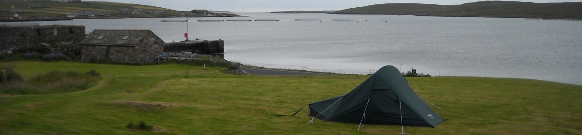
My tent is to the left. Abandoned cars to the right.

There was one fire station building and a tiny waiting room with a toilet and wash basin with cold water. A few abandoned cars were parked in the car park alongside the runway. I wandered around for a while over the boggy ground trying to find a slightly less boggy bit on which to pitch my tent. There only seemed to be one bit and that was quite close to the runway. I was no closer than the cars though, and it wouldn’t have been the worst thing in the world if I had to move my tent next morning before the first plane arrived.

Lots of curious sheep watched me pitching my tent. They were all over the runway – I don’t know what happens when a plane is due? – does someone have to chase them away? Once my tent was pitched I sat on stone seat and finished my flask of coffee. It was a mild evening and was lovely to be sitting there so alone in the mist, staring at the sheep who were staring right back at me. Apart from the odd ‘baa’ it was completely silent.  

After a while the mist seemed to be lifting a little so I walked to the far end of the road and back. It was really eerie walking along and seeing shapes looming in the mist. Not knowing if they were houses, sheep or abandoned cars until I was quite close. I could hear a few sounds of life, but saw no-one. On the way back to my tent the mist lifted even more and it started to rain. I gave up my walk as it was getting a bit late anyway, and hibernated in my tent for the rest of the evening.

Lunna Ness

A walk around Lunna Ness

Monday 1st August, 2011

I was up before 8am for a shower and to get packed up. I left my tent till last and was able to pack it completely dry. Even the underneath was dry. The ferry was at 9.30am. I was really quite sad to be leaving Skerries. I’d had such a lovely weekend and the community seems so friendly and vibrant.
The weather wasn’t quite as nice today and although the water in the harbour was calm, as soon as we cleared it the ferry was rocked all over the place. I wasn’t worried about myself, but I was really nervous about my car. As I’m expecting bits to drop off it anyway, this probably wasn’t particularly good for it. I sat in Jill’s campervan watching it through the back window. Even Mutley was very subdued. He only started to liven up when we got into calmer waters close to Mainland.
Spirit DancerWe drove round to the other small harbour in Vidlin and found the Spirit Dancer canoeists. The weather had really changed and was quite cold and raining a bit. The canoeists thought that maybe no-one would turn up and they wouldn’t go out. Jill and I parted company at this point. She was going to Lerwick to find out about ferries back to Orkney and I was going for a walk round Lunna Ness and then heading west ready to go to Foula tomorrow.
I drove down to the end of the road at Outrabister where there is a small parking bay. Jill had told me about an interesting second hand shop in the last house on the peninsula. It’s in an old byre and still has the drainage hollows running along the floor. It was packed with stuff, but seemed a bit junky so I didn’t buy anything. The guy was really friendly and chatty. He had a huge house, but can’t make any money from the shop. There was a big modern barn outside and lots of sheep so he must do farming as well and the shop is a kind of hobby. I didn’t get chance to ask him though as he was waiting for a phone call and when it came he had to go and meet someone on the road with some ‘messages’. The phone call came as I was talking to him and curtailed the conversation. Before he went he pointed out a hill with a bit of a track that I could get good views from.
moorland and lochs
Stanes of StofastI sat in my car and had lunch and then got my boots and wet weather gear on and headed back down the road walking, to where I spotted a sign post to the the Stanes of Stofast. It was a boggy, soggy moorland walk to get to them and took over an hour. It shouldn’t have taken that long, but for the zigzagging and backtracking I had to do. The rocks were quite impressive; huge boulders displaced by glacial movement. Originally they were a single 2,000 tonne boulder that drifted from Norway on the ice and was later split into two by frost. There were great views from up there as well.
Trig pointI then walked closer to the coast and then back inland to get to the trig point at the highest point on the peninsula. I walked a bit further towards the end of the peninsula before circling back and making for the hill that the man in the shop had pointed out. Then it was back down the track to his yard and back to my car. Apart from a few odd bits of blowy drizzle, the rain stayed off and I had a nice ‘fresh’ walk.
rocky cliffs

Lunna House
Other points of interests in this part of Shetland include Lunna House – formerly a farm estate house, but now better known as the base for the Shetland Bus. The Shetland Bus was the code name for the boats which plied the sea between Shetland and Norway to aid Allied efforts in the Second World War. Small fishing boats smuggled saboteurs, radios, explosives and ammunition into Nazi-occupied Norway and brought compromised agents back to Shetland.
Lunna ChurchThe church is also quite interesting as it has a hole in the wall that was thought to have a been a ‘leper’s hole’ – anyone with leprosy could stand outside by the hole to hear the service without risking the health of the rest of the congregation. Historians these days think the hole was more likely to have been part of the heating system.

Out Skerries

A day spent exploring Out Skerries.

Out Skerries (or just ‘Skerries’ as it’s known locally) is to the northeast of Shetland Mainland. It’s an archiplego of three tiny islands, two of which are inhabited and connected by a very short bridge. The islands are reached by a ferry which docks in Bruray. There is a population of about 70 and a mile or so of roads. There are 2 shops, one of which operates as the post office, a primary and secondary school, a church and a community centre.

The road and airport
Loading Spirit Dancer onto the ferryI camped near the pier on a grassy patch next to the shop. There is a toilet and a free hot shower by the pier so it was handy to be close by. On Sunday morning, after waving goodbye to the crew of The Spirit Dancer as it departed by early morning ferry, I went for my first walk of the day.

Spirit Dancer crew waving goodbye

I stuck to Bruray for this walk and headed out past the airstrip and the small loch and up on to the hill to get a good view of the lighthouse and the uninhabited island of Grunay.  

lighthouse on Grunay

There is a water viaduct going right round the island and I followed it for a while. It’s not big and can’t be seen from below; it looks more like a piece of guttering set into the ground. But it must have taken some work to install it.

viaduct

View from cairn
It was a beautiful sunny day with good views. I met fellow camper Jill and her small dog Mutley sitting by a cairn at the top. On the way down I stopped to watch a seal and to take photos of jumping salmon in one of the several salmon farms. It took me ages to get a half decent shot.

fish farm
I went back to my tent to make lunch and  then sat on a stone by the harbour to eat it. I could have sat there all day, but I wanted to explore the bigger island of Housay. After chatting to a few people, including a couple with a 7 month old son and a small dog, and after an ice-cream from the shop, I set off on my afternoon walk.
bridge between islands
I started out with Jill and Mutley and we crossed the bridge and walked to the island’s second shop and post office, but it was closed on a Sunday. We then headed up hill to find and old stone circle. This is known as The Battle Pund and is more of a rectangle than a circle. It’s 13 metres across and is marked out by boulders dating from the Bronze Age. No-one knows what it was for.
Battle Pund
After this we parted company and I walked over most of the island only getting back at about 6.30pm. I walked to the far end of the island and came back via another fish farm and the small fish factory. I collected a lot of shells that had been dumped in what to future archaeologists will look like a midden. I dropped down to the church and small cemetery before heading back along the road.
chapel
school school vegetable garden
On my way back to my tent I stopped to have a nosey around the school. It’s small but with decent sized classrooms. There seems to be a library and teacher’s area in a portacabin outside. The school looked really nice and had a playground at the front with swings and things and a vegetable garden at the back. It’s an eco-school as well.
Pier

Spirit Dancer

Arriving in Skerries and feeling like part of the community.

The Out Skerries are 3 small islands to the north east of the Shetland Mainland. Two of the islands, which are joined by a very short bridge, are inhabited by approximately 70 people. The third is slightly further away and currently uninhabited.

I arrived in Skerries (as it’s known here) on Saturday afternoon following a one and a half hour ferry journey from the northern end of Mainland. A quick drive around showed just how small these islands really are, as I’d no sooner set off when I came to the end of the road. Turn around, go the other way, same thing.

The main road in Skerries

I wandered into a building that seemed to have a lot of people coming and going from it. As I peered through the glass in a door I could see a kitchen and several women bustling about preparing salads and kebabs. They waved me in and I asked about camping on the island. Basically anywhere would be ok, but by the pier could be good as there are toilets and showers there. Or I could camp by this building, which was the community centre, as they had a group of Canadian canoeists staying there and so the building would be open if I needed to get in for the toilets. The food they were preparing was for a barbecue in honour of the canoeists and I was invited.

Barbecue

CeilidhI set up camp by the pier and just after 6pm returned to the community centre for the barbecue. Just about all of the inhabitants were there plus various weekend guests. The canoeists had a long 18 seater canoe based on native Canadian designs. Chris Cooper, his wife and a few others had brought the canoe to the UK and were spending a few summers taking it around different communities and trying to get as many people out on the water as possible. They’d had everyone from babies to 90 year olds on board.

The food was wonderful, the bar was open, the company was welcoming. After the barbecue we moved indoors to watch a slideshow, and Chris presented a specially made paddle to the community. Then the fiddles and accordians came out and the music and dancing started.

As it began to go dark the canoeists said they would need to move their canoe from the small harbour near the community centre round to the ferry pier ready for it to be loaded on to the ferry next morning so it could begin its journey to its next destination. Did anyone want to help? Of course they had plenty of offers, one of them being mine. We made our way down to the canoe, put on life jackets and slotted ourselves into position. After a quick lesson on how to paddle we were off. We closely skirted a fish farm and passed under the bridge. All too soon we were at the ferry pier. As it was getting late and I was by my tent I decided to call it a night. It had been a great evening and I loved what was essentially canoeing home from the pub.

I really have to learn to canoe or kayak and get myself one.

http://www.spiritdancercanoejourneys.ca/

Whalsay Walk

An island known for whales, fishing and its connections with the Hanseatic League.

Friday 29th July, 2011

Whalsay is approximately 5 miles long and 2 miles wide. The name means Whale Island and it is often a good place to see whales.

Whalsay was known for playing an important role in the salt fishing trade. This trade was for years in the hands of merchants from the north of Germany. Ships from Hamburg, Bremen and Lubeck would sail to Shetland every summer bringing a cargo of seeds, cloth, iron tools, salt, spirits, luxury goods and cash. They would exchange these for the Shetlanders’ fish.

The business was tightly controlled by a group known as the Hansa or Hanseatic League. This was an economic alliance of trading cities and their merchant guilds that dominated trade along the coast of Northern Europe. The Hanseatic cities had their own legal system and systems of protection and aid.

The League was originally created to protect the commercial interests of the merchants in the places they visited. Import duties imposed after the Treaty of Union between England and Scotland in 1707 finally broke their hold.

By the harbour in Symbister, close to where the ferry docks, is one of the two bods (small warehouses) used for the saltfish. It’s possible to rent a very large and heavy old key for £1 from the local shop to gain acces to the bod. Inside there are just 2 rooms – one upstairs and one downstairs. Both rooms have an exhibition on the salt fishing and the Hanseatic League.

The Walk

Approx 5 miles / 8km (though I probably walked more with all the backtracking and zigzagging
About 4 hours including stops
OS Explorer 468; Landranger 2
Start – park at Nisthouse just through Isbister
Grid ref – HU581641

After parking the car in a bay overlooking the sea I walked back along the short bit of road to Loch Isbister. The loch is only small. The houses all looked quite big and were each standing on their own patch of ground. A couple of new wooden houses were being built. It all looked quite prosperous. One of Ann Cleaves books (Red Bones) set on Whalsay refers to the wealth of the locals being based on fishing and from the look of the houses I could see that there definitely seemed to be some wealth here.

I walked along the north side of the loch through a series of gates and past a few plantiecrubs (rings of stone walling just over waist height – they were used to plant cabbages in to protect them). It was quite boggy in places. Then I headed north east and gained height to cross the moorland. This was really boggy and swampy and I spent a lot of time zigzagging and backtracking to pick my way through the driest bits. Consequently it took a lot longer than it should have done. Halfway across the moor are the remains of a chambered cairn. There is a small rectangular hollow in the ground lined with flat stones. As I dropped down from the moor in the north east corner of the island I came close to the road, a few houses and the airstrip. To the east and north of the airstrip is a golf course – Britain’s most northerly.
I ducked under a broken gate at the end of the airstrip to sit for a while on a lovely bench overlooking the golf course, the amazing coast and distant views of the distinctive cliffs of Noss. Then I ducked back under the gate and walked along the west side of the airstrip to reach the golf clubhouse at the far end. A track to the other side of the clubhouse led out across the course, along the edge of the coast to a cairn with views of the small island called the ‘Inner Holm of Skaw’. This was close to the shore and looked as though it might be possible to wade across at very low tides. I then followed the coast east for a short way to Skaw Taing and then in a generally southerly direction back to my car. This bit of coastline has lots of geos which I peered down. There are also the remains of a couple of Neolithic homesteads. One still has clearly defined rooms. These are below the cairn I visited earlier. People would have lived here three or four thousand years ago and their dead would have been buried above in the chambered cairn.
This was a lovely clear day for this walk so I got good views. The walk wasn’t difficult, just a bit tricky picking my way through the boggy moorland which meant it took 4-5 hours instead of about 3 hours.

Muckle Roe Walk

Seals, a lighthouse and slabs of pink rock.

Rock formations on Muckle Roe
Muckle Roe – South Ham
10.6km / 6.5 miles
4hrs including stops
Start – car parking on grass verge at end of public road at West Ayre
Grid ref HU322629
OS Explorer 469; Landranger 3

Muckle Roe is an island in the Northmavine area of the northwest Shetland Mainland. It’s found at the end of long single-track road and is joined to the mainland by a small bridge.

The Walk

The path is signposted between two houses for the Hams (4km) and for the lighthouse (2km) – I followed the path for the lighthouse which immediately dropped onto a little beach. Then it climbed up the other side and followed the coast along. After a while it moved slightly inland and took me to the very still Gilsa Water, a small loch.

Gilsa Water on Muckle Roe

Muckle Roe lighthouse
Heading upwards and away from the loch back towards the coast I passed pink and red granite rocks until reaching the small lighthouse. After this, rather than a clear path, there seemed to be just an expanse of boggy peat and heather with a criss-cross of sheep trails. According to my walk book I should have stayed close to the coast, but picking my way through the least boggy bits of the bog took me between several small lochs instead. I got divebombed by a frantic skua for a while and must have got quite close to its nest as it got very threatening and came really close. By the time it stopped I was getting arm ache from holding my stick above my head.

I could see Papa Stour really clearly as I walked along and when I got to South Hams at the far end of my walk I could also see the drongs in St Magnus Bay far off in the distance. The drongs are three huge stacks looming out of the sea which can be seen from Braewick cafe and campsite. I don’t know where the name ‘Hams’ comes from, but like to think it might be because all the big pink rocks look like slabs of ham.

Pink slabs of rock on Muckle Roe

I dropped down onto the small pebbley beach and could hear seals as I descended. A couple I’d met earlier said they had seen seals here. I made a lot of noise as I clamboured over pebbles and settled myself down to have lunch. Sure enough, the seals, which were in rocks to the right of me (the rocks were in the water so I couldn’t get to them) got curious and swam out to have a look at me. In all I saw three common seals and they came quite close.

A geo on Muckle Roe

Leaving the beach, after half and hour, I took the clearly defined track back to West Ayre. It climbed up and down a bit, but was very easy walking and passed another couple of small lochs.

Rock formations on Muckle Roe

Up Helly Aa

Learning about Up Helly Aa

I’ve decided to add attending the Up Helly Aa festivities to my list as it’s something that would be amazing to see, but quite difficult because of the time of year. Not school holidays. So whenever I find myself with time off for whatever reason, at the right time of year, I’m heading up to Shetland to see Vikings and burning boats.

The main festival is in Lerwick and is held on the last Tuesday in January, but there are others held throughout the islands until the end of March. The parade and boat burning is open to everyone and of course would be wonderful, but the real fun seems to happen in the evenings when the various Jarl squads (Viking gangs) go round lots of halls and basically party all night. The halls are private invitation only and so to get the most out of the experience I’d have to sneak an invite. This might be easier to do in the islands rather than in Lerwick.

As I’m in Lerwick,  I went to the Up Helly Aa exhibition in the boat shed. There were lots of costumes, shields, and part of a replica boat displayed. As well as Viking costumes, the various squads each choose a theme and people dress according to the theme, so there were also costumes in the shape of cartoon characters, chocolate bars and so on.

I watched a video showing the year long preparations for the festival and what happens on the day itself. The preparations involve the making of the boat, all costumes, shields and torches. During the day the squads visit schools, the old folks’ home, the hospital, etc so that everyone gets to be involved. Then they have the main march through misty, hazy, gloomy, drizzly, wintry Lerwick. It looked so atmostpheric on the film. At the end of the march the boat is burnt. It doesn’t get put to sea as I’d thought, but is burnt on dry land. All the Vikings toss their burning torches on to it. As they stand all around it I wondered what would happen if one tossed their torch too far and it sailed over the top into the crowd on the other side!

Some of the snippets of interesting info I picked up in the exhibition include:

  • The lead Viking is known as the Guizer Jarl – ‘Guizer’ comes from the word ‘disguise’ – the members of the various squads wear masks all day so no-one knows who they are. However, the members of the Guizer Jarl’s squad are all dressed as Vikings and don’t wear masks meaning they can be identified. They all seem to have beards though – do they grow them specially for the event?
  • Only men can go on the parade.
  • You have to live in Shetland for five years before you can join a squad.
  • You have to be chosen to be on the organising committee.
  • You work your way up through the ranks on the committee for 15 years – then in the 16th year you are Guizer Jarl.
  • You start as a ‘water-carrier’ making sure everyone in the squad has enough water in their whisky.
  • It’s very expensive – you need to save up to be Jarl and to raise a lot of money.
  • During the day the Guizer Jarl’s squads go round the schools, old people’s homes and the hospital performing, as well as performing and parading in the streets.
  • Each squad has a theme for their costumes and performance which is kept secret – only the committee knows to make sure there is no overlap.
  • In the evening, there is a torchlit parade through Lerwick ending with the burning of the boat.
  • Then the squads spend the rest of the night going round the halls, eating, drinking and performing.
  • Each squad goes to each hall in a pre-planned order. The Guizer Jarl’s squad goes the opposite way round to the others so they meet each of the others in turn.
  • Torches are made from 4ft long, thick pieces of wood. Three sacks are rolled round the end and nailed into place. A fourth sack is nailed over the top. Cement is put where the sacks and pole meet to prevent the pole from catching light.
  • The sacking end of the pole is soaked in parafin for about 24 hrs. The whole thing ends up weighing 14lbs.
  • After Up Helly Aa the Guizer Jarl joins the ex-Jarls and starts at the beginning again as a water-carrier. The job of the exes is to advise the others.
  • The halls are privately rented by people who invite their family and friends and prepare loads of food. As they are private you can only go to them if you have been invited.
  • The hall parties last all night.
  • The schools now have junior Jarl squads.

What a festival! And in one of my favourite places too.

Plans

Making plans for the summer: Shetland and the Great Glen Way

I’ve been trying to get hold of my friend in Glasgow for a while now. As I’m going up to Scotland for the summer and I haven’t seen her for a while it would be nice to catch up. Also I was hoping to be able to leave my car with her when I walk the Great Glen Way. I could leave it in Fort William or Inverness but as I’ll have a lot of gear in it I’d rather it was somewhere more secure. After several wrong numbers I finally got hold of her this evening.

I wanted to walk the GGW first and then nip back to Glasgow to pick my car up before driving to Aberdeen to catch the ferry to Lerwick. However, because of her shifts it’s actually better to do it the other way round as I’ll get to see a bit more of her if I stay with her later in August rather than this weekend. So tomorrow I have ring Northlink to try to get booked on to the Monday night ferry. It’s usually a 14.5 hr journey but because the Monday night ferries don’t call into Orkney it’s slightly shorter.

It’s not so bad doing the trip this way round as I can do lots of walking in Shetland to get myself trained a bit more ready for my long walk. It also gives me more time to organise things like getting a key for the toilets at the locks along the way. I’ll try giving them a call tomorrow as well and see how much it is to rent/buy the key and how I actually collect it.  

I had been planning to leave tomorrow but as I still have lots to do before I’ll be ready to leave I’ve decided to put it off until Sunday. Which is my birthday. And I like going on holiday on my birthday.

Country Tracks Exmoor

Floods caused by military experiments to make it rain and sabre-toothed tigers roaming around with ponies. I think I’m glad I didn’t know this before I walked in Exmoor.

I’ve just watched a Country Tracks programme on iplayer. I downloaded it ages ago and thought it was about time I got round to watching it before it expired. It’s the first time I’ve watched Country Tracks and I was only interested in this particular one because it was about Exmoor where I spent half term. It was an interesting programme though, so I may have to look out for others.

I learnt various things from it such as the Lynmouth flood may have been caused by the government and military experimenting with technology to make it rain. Also, that it’s thought that Exmoor ponies originally came from Alaska thousands of years ago and would have roamed around with sabre toothed tigers. I was quite happy to see ponies when I was walking – don’t think I’d have felt quite the same way if I’d run into a sabre toothed tiger though!

A Quote

An apt quote for wild campers

Night is a dead monotonous period under a roof, but in the open world it passes lightly, with its stars and dew and perfumes … What seems a kind of temporal death to people choked between walls and curtains, is only a light and living slumber to the man who sleeps in a field. All night long he can hear nature breathing deeply and freely.

Robert Louis Stevenson