Planning a few more walks … including a very long, steep one.
I spoke to a friend this evening. She moved to Norfolk about 6 years ago and so far I haven’t got round to visiting her. Now that I’ve completed the Great Glen Way I’ve been thinking about which path to take on next. I’m still not ready for a very hilly, long one, so thought that the Peddar’s Way and the Norfolk Coast Path could be good choices. And I could visit my friend at the same time. My friend is keen to do the Peddar’s Way with me and said it starts about 10 miles away from her house. So we’ve tentatively pencilled in half term.
She also mentioned that she would like to climb Kilimanjaro before she is 50. As this is also on my list, we can now start thinking about it together and motivate each other. It’s something I really should have done years ago when I lived in Africa and spent time in Tanzania. But I wasn’t fit enough and couldn’t afford it. These are still issues now, but if I can focus then I can start working towards it.
The Ice Hotel is going to open in the summer … but it won’t be the same at all.
I’ve just read that the Ice Hotel in Sweden is going to be open in the summer. Usually this is a winter experience only as it melts each spring and has to be rebuilt the following year. Now a smaller version is to be built inside an art centre so visitors can stay in the summer and experience the midnight sun. No chance of seeing the Northern Lights though. And I don’t think I particularly want to stay inside an ice hotel inside another building. It just wouldn’t be the same at all.
What I realized—not just about myself but about the world—is that time and money are commodities with an inverse relationship; to get one you need to spend the other. And I realized, for me, time is a more valuable commodity than money, so I’d rather hoard free time than extra money. Most travelers end up feeling the same way and its one reason why they find the return home so difficult, our society is built on the premise we should want more money so we can have more things, even if we don’t really have the free time to use those things.
I received a letter today from Willow Wood Hospice about the charity walk I’m taking part in across Morecambe Sands later this month. The letter warns me to take a towel and a change of clothes and old shoes or trainers, definitely not wellies, for the river crossing. It says I will definitely get wet. The walk across the bay will take about 3.5 hours and the coach will be waiting at the end ready to take us home.
I’m really looking forward to this and just hope it doesn’t get rained off like it did last year. A bit of rain isn’t a problem, but last year it rained so hard all weekend the river swelled so much it was too dangerous to cross and the walk had to be called off.
So, fingers crossed for a dry weekend at the end of the month.
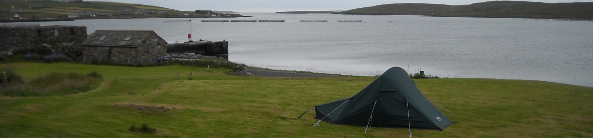
I had a leisurely start to today as I had no need to rush anywhere. I spent the morning walking out to the sea lock at Clachnaharry. This is about a 5 mile round trip and meant that not only had I followed the Great Glen Way in its entirety, but also the Caledonian Canal. The path all the way to the sea lock was busy with dog-walkers, joggers, boats, and residential and business premises. It was a gloriously warm and sunny day and a lovely end to my walk. Except it wasn’t the end really, as I still had to get to Inverness Castle.
The bridge was opening to let a boat through
Back near the campsite I called in at the Floral Hall coffee shop for lunch. This is a botanical garden, but as there was an admission charge and I didn’t know how much time I’d need to look round it properly, I didn’t go in. I’ll save it for another time.
Ness Islands
I went back to the campsite and spent a bit of time lying around reading before getting packed up for the walk across the Ness Islands to Inverness. The Ness Islands are set in the River Ness and joined by a series of bridges. They are all covered with woodland and make a pleasant park area for the people of Inverness.
Finally saw Nessie on the Ness IslandsThe official end of the GGW signInverness Castle
Finally the path reached Inverness proper and climbed upwards along roads to reach the castle and the GGW start/finish sign.
View from Inverness Castle
Once I’d taken the obligatory photos I headed for the train station and sat in the bar with a well-deserved beer before getting the train back to Glasgow.
Distance walked = about 7 miles (2 ‘official’ miles plus the 5 miles to the sea lock and back)
A world speed record not quite broken, a ruined castle, an abandoned Canadian lumberjacks’ camp, a secret cafe and first views of Inverness.
Tuesday 23rd August, 2011
The final full day of the walk. I got the same bus as I’d got yesterday morning, but because I was only going as far as Drumnadrochit I was able to start walking a lot earlier.
The path starts by following the A82. At first alongside the road but then on a separate path. A couple of miles in and the path started to climb away from the road.
Temple Pier
Information boards told the story of how, on the other side of the road at Temple Pier, on the 26th August, 1952, John Cobb’s Crusader had arrived and been lowered into the water ready to begin preparations to attempt to break the World Water Speed record. Crusader was the first water-borne craft to be designed and built for jet propulsion. The board shows a picture of a white craft looking more like a space capsule than a boat.
Over the next month Cobb and his twenty-strong support team used the pier as a base as they carried out trials on the loch. The world record attempt took place on the 29th September, 1952 amid great excitement. The Inverness Courier reported what happened next,
“She skimmed over the course … but then seemed to bounce twice on the water … next moment the horrified spectators saw the boat plunge into the loch in a whirl of spray and foam flecked with flying wreckage”.
John Cobb was killed in the crash, the cause of which has never been explained. Although, Cobb did have the triumph of travelling on water at over 200 miles an hour, this didn’t count for the world record. For it to be official he needed to travel a measured course of one mile and then return. The average speed over the two runs would have been used to calculate the official speed, but as he crashed before completing the second mile his average speed couldn’t be calculated.
Urquhart Castle on the peninsula
Continuing, I came to a nice spot where I could look along the loch and get a good view of Urquhart Castle. The ruin is said to be the most photographed site in Scotland, partly because it is very picturesque, but also because it is known as one of the spots where Nessie the Loch Ness monster has been most frequently spotted.
Further along, I came across more illustrated information boards. This time they informed me of a Canadian lumber camp that had been here during the second world war. Huge supplies of timber were needed for the war effort and extra forresters were needed to provide it. The government put out a call for help and by 1941 over 2000 Canadian lumberjacks had answered the call and arrived in this part of Scotland. Many were from Newfoundland and so the men became known as ‘Newfies’.
The timber they produced was used for mine props, obstruction poles to stop enemy craft from landing on beaches and fields, telegraph poles, crates for shipping military equipment and for building accomodation and mess rooms for soldiers.
Many of the men married local women and whilst some settled in Scotland, others returned home with their Scottish wives. A Highland Canadian Wives Club was formed to help women prepare for life in Canada after the war. Little remains of the lumber camps now apart from a few odd bits of cable and railway.
The path joins a forest road and I followed this to the highest point on the whole GGW at 375m. The road then descended for a way to get to Abriachan. This is a kind of woodland outdoor centre with a car park, picnic tables, eco toilets, and lots of bird houses and sculptures. I stopped here for lunch.
A short while further on I bumped into the Canadians again (we’d been passing each other all day) as they were emerging from what seemed to be overgrown brushland. There is a campsite and cafe hidden away in it and they’d just stopped for a cup of tea. Curious, even though I’d already eaten, I picked my way through boggy paths to find it. It’s quite a bizarre place run by an eccentric couple. It seems overgrown yet is actually maintained with fruit and veggies growing, chickens roaming about and a pond. I had a freshly squeezed orange juice (yum, vitamins – something I felt I was lacking living on instant noodles and cup-a-soups) and chatted to the couple.
They’ve owned the land for a few years and live in a caravan on it. They started offering camping as way of getting people to camp officially rather then wild camping and using what is essentially their garden, as a toilet. I got an elaborately hand-written receipt for my orange juice; something to do with placating the tax man.
The path continued on the level and then met the road which I followed across the Abriachan plateau for a couple of mile or so. Then I joined a path which rises again and got my first views of Inverness in the distance. The path began descending and entered a forest through which I walked for several miles. The path then drops steeply into Inverness. I had to stop several times to give me knees a break. Once on the outskirts of Inverness I was back to walking through a housing estate just like at the beginning of the walk.
The path joins the canal again near the campsite. I was about 2 miles (if that) from the end of the walk at Inverness Castle but didn’t see the point in walking past the campsite into Inverness, just to walk back out the campsite again, and then walk back in again tomorrow to get the train. So I went straight to my tent instead.
Friendly cats, ups and downs, too much road walking, but still no sign of Nessie.
Monday 22nd August, 2011
I got up early and trekked to the bus stop. It’s quite frustrating having to walk all the way round – walking past my tent 10 mins after I’ve just left it! I can understand why there’s no gate at this end of the campsite because if there was anyone could walk in and there could be quite a security issue. But I’m sure they could have put the vehicleless field nearer the main gate!
The bus back to Invermoriston was a lot more expensive than the one I’d got yesterday. Apparently there are different companies running the routes and they all have different prices. Oh well, it’s worth it, not to be carrying my heavy pack. I still have the pack with me as I don’t have a daypack, but it’s almost empty and really light.
Once in Invermoriston I bought a sandwich for breakfast and sat in the shop’s garden to eat it. A couple of friendly cats joined me and I fed them bits of hard-boiled egg from my sandwich.
I wandered round Invermoriston for a few minutes (really, that’s all it took) and bumped into the Canadian women again. The men had already set off walking (I saw them several times throughout the day), the women were taking the day off and going to get the bus to Urquhart Castle instead.
The path begins by climbing very steeply along a narrow road behind the shops. In no time at all I was well above them. The path continued to zigzag upwards, though not quite as steeply. It climbs about 215m in the the first mile. It then drops to about 110 metres. The path joins a forest road and continues to descend until it comes alongside the A82. The forest road then climbs again to about 300m before dropping down again to 120m. At least I couldn’t complain about it being flat today!
The path climbs again towards Grotaig where it joins a small road. There are some paths at the side of the road, but a lot of the time I was walking on the road itself. This section is about 3 miles long and was very hard on my feet. Then I turned to descend on a gravel path before reaching the A82 and following this into Drumnadrochit.
Drumnadrochit is the main hub for all things Nessie. There are a couple of Nessie exhibitions and lots of cafes and shops. I was too late and too tired to do much more than wait for the bus though.
An ascent, a diversion, some Canadians, but no monsters.
Fort Augustus
Sunday 21st August, 2011 This morning even though it was Sunday the Fort Augustus shops were open and the tourists were out in force. I only had 8 miles to go today, but my pack was feeling heavy and my feet were feeling weary. This was the first day where it wasn’t flat and I was looking forward to a bit of inconsistency in the terrain.
I was now following Loch Ness and would do until almost the end of my walk. Loch Ness is one of the largest lochs, only Loch Lomond has a larger surface area. By volume however, it is by far the largest, containing more fresh water than all the lakes in England and Wales combined. It is just under 23 miles long and is 1.7 miles across at its widest point. Loch Ness is of course famous for its monster, but though I kept a good look out I didn’t catch so much as a fleeting glimpse of it.
Leaving Fort Augustus, the path immediately began to climb. It follows minor roads for a while, but is soon on forest tracks. The path kept its height with a few undulations. It was hard to see the loch for a lot of the time because of the tree cover. But it was also hard to hear (and see) the traffic down below on the busy A82, something which I’m not complaining about. Every now and again there would be a break in the trees and the chance to stop and drink in the view.
At one such viewpoint I was perched on a conveniently placed large, flat rock enjoying coffee from my flask when two older Canadian couples came along. They were walking the path too, but staying in B&Bs and using a baggage carrying service. I chatted for a while before moving on. I continued to see them on and off throughout the rest of the day.
As it got towards the end of the day I felt I was beginning to tire of carrying my back. The next two days are long days with a lot of hills and a lot of miles and I wasn’t sure how I’d go on. I decided to check out buses when I got to Invermoriston to see if it was possible to easily get to and from the Inverness campsite. If I could do this I could leave the bulk of my gear there and sleep there for the remaining three nights just getting a bus at the beginning and end of each day.
Almost at Invermoriston the path dropped steeply through woods to reach the main A82. Unfortunately because of damage to the trees the path had been closed for safety reasons. I had to follow a lane instead which added another couple of miles to my day’s walk. I really wasn’t in the mood for this. I was tempted to try the path and probably would have done if I didn’t have my big pack. When I got to the other end of the path I could look up into the woods and see the damage. It would have been really difficult to get through as trees were all across the path. So I’d made the right decision to follow the detour. I found a bus stop and checked the timetable. It being a Sunday I was hoping I wasn’t too late for the last bus. It was fine and I only had about 20 minutes to wait. The bus dropped me outside the campsite which is actually on the route of the GGW. I could see tents from the bus so thought I didn’t have far to walk. Wrong. The campsite is big. And the entrance is at the far end. I had to walk all the way down the side road to get to the entrance. The field for campers without cars was then at the other end of the campsite and so I had to walk all the way back again. I ended up with my tent quite close to the road and the bus stop, yet a good 10-15 minute walk away. I was not a happy bunny. It was good to get my tent up though and know I didn’t have to carry it tomorrow.
Distance walked = 10-11 miles (8 ‘official’ miles plus a couple for the diversion and the best part of a mile getting to the field I put my tent up in)
An old railway line, a military road, coffee and cake and playing catch.
Saturday 20th August, 2011
A soggy morning. I stayed in my tent for a while and eventually it eased off. I packed up in drizzle rather than a downpour. By the time I started walking it had cleared up well. Today’s walk is only 10 miles so I didn’t have to be in too much of a hurry.
The path goes along the south side of the canal to the small Loch Oich. There’s only about a mile of canal joining these two lochs. When I got to Loch Oich I went into the coffee shop at the Great Glen Water Park for a coffee and an orange juice. It seems like quite a nice place with log cabins scattered throughout the trees.
Leaving the water park the path follows the bed of an old railway line. Part of a station platform can still be seen as can the stone walls that would have been alongside the sunken track. Trains used to run between Spean Bridge and Fort Augustus but the line was never successful due to rivalries between different companies.
section of old station platform
The path then follows the remains of one of General Wade’s military roads. I sat for a while on a conveniently placed bench and looked across the loch to the ruins of Invergarry Castle. This used to be the seat of the MacDonald clan who supported the Jacobites and Bonnie Prince Charlie. It was burnt down after the battle of Culloden.
After the castle the path moved slightly inland. When it returned to the lochside just before Aberchalder I was surprised at how windy it was beside the loch. Aberchalder has a rather pretty old bridge (The Bridge of Oich). It’s now only used by pedestrians. This is where Loch Oich ends and the canal begins again. I found a lovely tea garden just by the canal and the bridge and sat with coffee and a cake for a while enjoying the warmth. Now I was back near the canal and away from the loch, the wind had dropped and I hadn’t seen rain since this morning. The tea garden had a couple of resident dogs who insisted on playing catch with me, though one really hadn’t got the concept of the game and kept forgetting to bring the ball back to me.
Just past the tea garden I crossed a bridge and followed the canal along a path on the north side. This was an even, flat path and, fortified by coffee and cake, I was able to get quite a pace going. I had a break at Kytra lock which was pretty and had nice grass for camping on, but no facilities. I considered stopping, but wanted to get another couple of miles under my belt, so carried on to Fort Augustus.
Fort Augustus is a busy little tourist town with the most people I’d seen since Glasgow. Because of the proximity to houses and businesses camping is not allowed at the lock and so I had to go up the road to the commercial campsite. This was a big campsite with several different camping areas. I was in a field for campers without vehicles. There were four young Spanish people with motorbikes and tents on the far side of the field from me, but that was it. It should have been a peaceful night. It wasn’t. The Spanish had set up a kind of communal tent as well as there own individual tents and proceeded to have a very loud party. If it wasn’t so annoying, I would have been quite impressed by how much noise could emanate from just four people! I ended up getting quite nowty and shouting over to them to shut up. To their credit, they did, and I was able to get a bit of sleep.
Disaster strikes twice, a fairy forest and the first rain.
Gairlochy
Friday 19th August, 2011
I woke feeling much better. It was a beautiful day and the sun had driven all the midges away. I sat at a picnic table for a while having breakfast and just enjoyed sitting in such a lovely place. I couldn’t stay too long though and had to rouse myself to get packed away. I appreciated why the guys I’d met yesterday had enjoyed taking so long. If I wasn’t on a restricted timetable I would have loved to be able to spend a few hours, if not the whole day, here.
I hoisted my backpack up onto the picnic bench and disaster struck. One of the straps that holds the pack closed caught on the bench and the buckle broke. It was unfixable and wouldn’t stay fastened with only half the buckle. Luckily I always have a stash of duct tape wrapped round my walking poles so I was able to use some of this to wrap round the buckle and keep the pack closed. It worked really well, but did mean that to open my pack I had to carefully unwrap the duct tape, stick it on the side of my pack and then carefully peel it off to wrap it round the strap again when it was time to refasten my pack. A whole lot of faffing, but at least I’d fixed it.
I hoisted my backpack up onto my shoulders and disaster struck. (Didn’t I write this already?) The waist strap caught on the picnic bench and the buckle broke. I couldn’t carry my pack all day without the support of the waist strap so I had to fix it. Duct tape wasn’t an option here as it would be too difficult to get the pack on and off. I managed to figure out a way of tying one end of the strap to the other and it held quite well. Maybe it’s time I got myself a new backpack.
Finally, I was able to set off. The path headed away from the loch on the north side. It climbed up into a thickly wooded area which seems to have been converted in to a fairy glen. A very large area was filled with glittery and shiny baubles. There were trees that seemed to be fruiting teddy bears or wellington boots. Umbrellas were arranged over fairy tea parties and plastic flowers bloomed. The conservative part of me thought it was an eyesore in such a nice place, but the fun part of me loved it. I don’t know who has done this here, or why, but it’s certainly different.
The path continued on the north side of Loch Lochy all day. I finished the day at South Laggan locks which are at the far end of the loch and where the path joins the canal again. The walk took me through woods all day and although I did get to walk alongside the loch for a couple of miles after the fairy wood, most of the time I was higher than the loch and only got glimpses of it through the trees.
Towards the end of the day it began to rain. It started off quite light, but got heavier and so I had to stop and put wet weather gear on for the first time. It was still raining heavily when I reached South Laggan and had to put my tent up. Luckily it doesn’t take long to get the bulk of it up and I could chuck my gear inside whilst I finished pegging it out properly.
There were a lot of boats moored up for the night and a few other campers too, but the area wasn’t as nice as Gairlochy locks. Nice enough I suppose, but not the sort of place I’d want to linger even if I did have the time.