
Easter Saturday was a gorgeous sunny and warm day; perfect for exploring the beautiful beaches of Dorset’s Studland Bay. Starting from the Sandbanks ferry we hopped across to the Isle of Purbeck and spent the whole day dipping in and out of the different beaches until we got to Old Harry Rocks at the the Southern tip of Studland Bay.
But before I tell you all about it, a bit geography. Have a look at the map below.
Poole Harbour is a large, almost completely closed-off, natural harbour. The Isle of Purbeck lies to its south and west. This isn’t a real isle, but a chunky bit of land jutting into the sea and surrounded on three sides by water. On the other side of Poole Harbour you have Poole (the town) and Bournemouth with the narrow peninsula of Sandbanks lying between them. Sandbanks stretches almost all the way across the mouth of the harbour leaving just a narrow gap for boats to pass through. From the southern tip of Sandbanks, it’s just a short hop across to the north-eastern tip of Purbeck where Studland Bay begins.
Studland Bay looks like a bite that has been taken out Purbeck. It stretches to the Old Harry Rocks. Continuing further round the Isle of Purbeck, a second ‘bite’ forms Swanage Bay which runs from Old Harry Rocks to the town of Swanage and the viewpoint at Peveril Point.
Studland Bay has a four-mile stretch of golden sand which makes up Shell Bay Beach, Knoll Beach, Middle Beach and South Beach. As all are owned by the National Trust it means they are well looked after and the parking is free if you have membership.
Okay, enough of the geography lesson, now for the good stuff.

We’d looked at different ways of managing our day exploring Studland Bay from Sandbanks to Old Harry Rocks and although we’d wanted to walk, it wasn’t that easy to figure out the public transport at either end.
We were staying just outside of Poole and so would have had to get a bus into Poole and then a bus to Sandbanks and then at the end of our day get a bus back to Poole and then back to the hotel. After studying the bus routes and timetables (and knowing from my earlier walk from Bournemouth to Sandbanks that the last bus goes quite early) we didn’t think we’d be able to make the most our day doing it this way. Leaving a car a one end would only have meant lots of backtracking and seemed even less feasible.
So even though, I would love to walk this part of the coast one day, we decided that would have to be for another time. Instead we took the car and drove the route from beach to beach. We had a such lovely day doing it this way and could go at our own pace, so it did turn out to be the perfect way to do it.

We started in Sandbanks rather than going directly to Studland because we wanted to experience the Sandbanks ferry.
The ferry takes passengers and about 48 cars and runs a regular daily service across the mouth of Poole Harbour. The only other way of getting from one side to the other would be a very long drive right the way round the harbour (about 25 miles I think).
I’m used to getting car ferries when I hop between islands in Shetland, Orkney and the Outer Hebrides, but this is a ferry with a difference. It’s a chain ferry, which is exactly like it sounds. A chain is connected to both sides of the harbour mouth and the ferry is pulled across by it.
It’s not possible to pre-book the ferry. We expected it to be busy so got there early. We still had to join a line of cars winding though Sandbanks waiting to get on. There are signs at different points, a bit like those for the rides in theme parks, saying ’15 mins wait from here’, ’30 mins wait from here’, and so on. We had to wait about 15 mins but that gave us time to gaze at the amazing homes lining the road. Sandbanks is one of the most expensive and exclusive places to live in the UK.

Once across we headed straight for our first beach of day – Shell Bay Beach.
After parking in the National Trust car park with not a peep of the sea or beach in sight, we followed a wooden walkway through a swampy area of dunes and heathland that reminded me of mangroves in Africa.
Suddenly, we were off the walkway and this view opened up in front of us.

White sand, tufts of dune grass, blue sea, blue sky, and Sandbanks in the distance.
From this beach we could watch the Sandbanks ferry chugging backwards and forwards. It’s also the place to watch ferries leaving Poole Harbour for the Channel Islands, though I don’t think I saw any of those.
The heathland spreads inland and would make for an interesting walk, but we were here for the beaches.

We flopped on the sand and just stared at the sea for a while.
Then it was back to the car and off to the next beach of the day – Knoll Beach

It is possible to walk from Shell Bay Beach to Knoll Beach, but do be aware that there is a naturist/nudist beach between the two. Apparently it’s the most popular one in Britain. I doubt it’s compulsory to get your kit off, but if your sensibilities would get in a wobble at seeing other people’s bits doing their own wobbling, then maybe avoid this bit of beach.

Knoll Beach is the most commercial bit of Studland’s four-mile stretch of beaches. It has an area just behind the beach with a National Trust shop, a cafe, ice-creams and boat hire.

We bought ice creams and sunscreen. (In April. In the UK. Really!) We sat on the beach here for quite a while and I even paddled my feet in the sea.

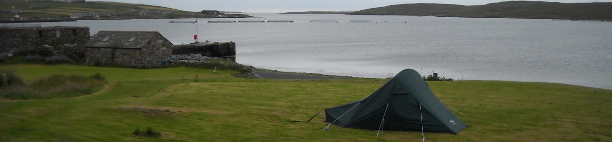
The next beach was Middle Beach. We saw a difference here as we were higher and had to walk down to the beach. Shell Bay and Knoll Beaches had been on the level with the car park.
Middle Beach still has some of the defences that were laid in the Second World War in case the Germans tried to invade. In the photo below you can see some dragon’s teeth – these jagged concrete blocks were to stop tanks.


As well as the WWII defences there are also some cute beach huts to look at here. Unusually, they are set back a bit from the beach. There have been beach huts at Studland for over 1oo years and so they’re firmly part of the heritage now. There are currently about 260 of them.

The National Trust owns fifty of them and rents them out. Some are rented out long-term but they do have some for daily and weekly rent. If you’re interested it’s £50 a day in high season or £220 for a week. If you’re looking for long-term, it’s currently £1,275 for the year. The waiting list is full though, so you’d have to really plan ahead for a future year.

Time was getting on by the time we’d finished exploring Middle Beach and we were getting hungry. Fortunately, as we arrived at South Beach, we just happened to come across a little beach side cafe and were able to get a table right by the beach to eat our lunch.

Lunch over, it was time to head for the day’s icing on the cake – Old Harry Rocks
The route to Old Harry Rocks forms part of the South West Coast Path – a long-distance trail which stretches 630 miles around the south west coast of England from Somerset to Dorset. It actually ends (or begins) at Shell Bay. It’s one of the many paths I’ve walked part of but have never got round to finishing. I get far too distracted by things along the way.

Old Harry Rocks are chalk formations with the actual Old Harry being the single stack standing furthest out to sea. I read that he used to have a wife, but she eroded and is no more.

I got the perfect day to see them. I’m sure they’d be impressive no matter the type of day, but on the sunny day I got, the white of the chalk really stood out against the blue sea and sky giving them extra wow factor.

It’s unclear where Old Harry got his name from. Some say he was named after a local pirate called Harry Paye who used to hide his ship amongst the rocks. Others say he was named after the devil. It’s claimed the devil used to sleep on the rocks and as Old Harry is a nick name for the devil, the rocks became known as Old Harry’s Rocks (now it’s just ‘Old Harry’ and not ‘Old Harry’s’).

To get to Old Harry Rocks from the car park you go down a lovely little lane and then across a big grassy plain along the top of the cliffs. The views are fantastic. It’s possible to make the route back to the car park into a circular walk, but as that involves walking back inland and we wanted to stay by the sea, we walked back the way we’d come.


Exploring Studland Bay from Sandbanks to Old Harry Rocks was such a fabulous way to spend a day. Of course it helped that the weather was so good, but this coastline probably looks pretty good no matter the weather.
Here’s a fun fact to finish with. Do you remember Enid Blyton’s ‘Noddy’ books? Well they were set in the Studland area with Noddy’s home of Toytown being based on Studland village.
So have I inspired you to visit Studland Bay? Maybe you’ve already been? What are your favourite bits of coastline? Share your thoughts in the comments below.
Books to read that are relevant to your visit:
- Enid Blyton and Her Enchantment with Dorset by Andrew Norman
- Enid Blyton’s ‘Noddy’ books
- The Clifftop Murders by Rachel McClean (second in a series of Dorset crime books, this one has the murder scene at Old Harry Rocks)
- Summer at Studland Beach by Della Galton (A romance. I haven’t read it, but reviews say it has good descriptions of Studland Bay.)
Like this? Read these next:
- An Evening Wander from Bournemouth to Sandbanks
- Exploring the World’s Biggest Tank Museum
- An Afternoon at the Russell-Cotes Museum
Pin it for later


Thanks for such a detailed guide! I had no idea Studland Bay had so much to offer, from beautiful beaches to fascinating history. Your photos really bring the place to life, and I can totally see myself enjoying an ice cream at Knoll Beach or walking along the cliff tops to see Old Harry Rocks. The bit about the nudist beach between Shell Bay and Knoll Beach made me laugh—good heads-up! I also love the Enid Blyton connection; it’s fun to know that Toytown was inspired by this area.